
 Search
 Feedback
 About
About Help
Help News
News
| Listing 1 - 10 of 624 | << page >> |
Sort by
|
Periodical
Abstract | Keywords | Export | Availability | Bookmark
 Loading...
Choose an application
- Reference Manager
- EndNote
- RefWorks (Direct export to RefWorks)
Book
Year: 2022 Publisher: Berlin ; Boston : De Gruyter,
Abstract | Keywords | Export | Availability | Bookmark
Loading...Choose an application
- Reference Manager
- EndNote
- RefWorks (Direct export to RefWorks)
This volume offers the author's central articles on the medieval and early modern history of cartography for the first time in English translation. A first group of essays gives an overview of medieval cartography, illustrating the methods of cartographers. Another analyzes world maps and travel accounts in relation to mapped spaces. A third examines land surveying, cartographical practices of exploration, and the production of Portolan atlases.
Maps --- Reproduction.
Book
ISBN: 0857729837 1350987107 0857727850 9780857727855 9781784534547 1784534544 Year: 2016 Publisher: London
Abstract | Keywords | Export | Availability | Bookmark
Loading...Choose an application
- Reference Manager
- EndNote
- RefWorks (Direct export to RefWorks)
"Through a detailed study of the work of three of the leading figures of the era - Augustus Petermann, Physical Geographer Royal to Queen Victoria; cartographer Charles Meredith van de Velde, who produced the finest map of the region at the time; and Edward Robinson, founder of modern Palestinology - the authors explore the complex cultural, cartographic and technical processes that shaped and determined the resulting maps of the region. Making full use of newly discovered archival material, and richly illustrated in both colour and black and white, Mapping the Holy Land is essential reading for cartographers, historical geographers, historians of mapmaking, and for all those with an interest in the Holy Land and the history of Palestine."--Bloomsbury Publishing.
Book
Year: 2023 Publisher: Florence, Italy : Firenze University Press,
Abstract | Keywords | Export | Availability | Bookmark
Loading...Choose an application
- Reference Manager
- EndNote
- RefWorks (Direct export to RefWorks)
Leonardo's conception of drawing and painting as a "science", intended as a means to know material reality, in its application to the cartographic field highlights the Master's adoption of different criteria for selecting and arranging information content in maps. Considering some significant cases, the text highlights Leonardo's main contributions to cartography and proposes to consider these discrepancies as the results of an investigative process, in which the permanence and mutability of objects and territorial phenomena are evaluated in close relation with the project.
Book
Year: 2022 Publisher: Florence : Firenze University Press,
Abstract | Keywords | Export | Availability | Bookmark
Loading...Choose an application
- Reference Manager
- EndNote
- RefWorks (Direct export to RefWorks)
The Atlas of Territorial Heritage in the Municipality of East Havana is a useful tool in order to reach a complete knowledge of an extended Cuban municipality belonging to Havana, Cuba. At the same time the atlas is useful to generate analytical bases for future urban planning interventions and transformations, which can be focused on the idea of territorial heritage as an essential resource for a self-sustaining development. The main objective is to explain the tangible and intangible components of the heritage and try to stimulate and strengthen the community's awareness on the richness of territory and its potential. Thus communities can express themselves in the adaptation to environmental, climatic, demographic and economic changes. The Atlas was developed by an Italian/Cuban team of experts in different phases and has been updated recently. It contains the results of a deep and accurate analysis and cataloging, made up of a large number of data concerning the various areas of research. The data were organized in typologies and punctually located in maps. The multifaceted and dense richness of Cuban culture finds in this volume a confirmation, and makes possible to put into practice cognitive tools for safeguarding and valorization, a strong point for new challenges of contemporaneity.
Book
ISBN: 0128100699 0128010932 0128008660 1306977312 9780128010938 9780128008669 Year: 2014 Publisher: San Diego, California
Abstract | Keywords | Export | Availability | Bookmark
Loading...Choose an application
- Reference Manager
- EndNote
- RefWorks (Direct export to RefWorks)
ISBN: 1280594489 9786613624314 019153871X 9780191538711 019210053X 9780192100535 Year: 2003 Publisher: Oxford : Oxford University Press,
Abstract | Keywords | Export | Availability | Bookmark
Loading...Choose an application
- Reference Manager
- EndNote
- RefWorks (Direct export to RefWorks)
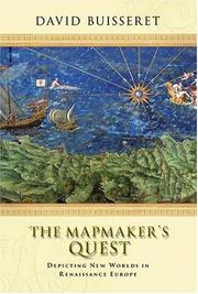
In 1400 Europe was behind large parts of the world in its understanding of the use of maps. For instance, the people gf China and of Japan were considerably more advanced in this respect. And yet, by 1600 the Europeans had come to use maps for a huge variety of tasks, and were far ahead of the rest of the world in their appreciation of the power and use of cartography. The Mapmakers' Quest seeks to understand this development - not only to tease out the strands of thought and practice which led to the use of maps, but also to assess the ways in which such use affected European societies and economies.
Cartography --- Maps --- History. --- History
Book
Abstract | Keywords | Export | Availability | Bookmark
Book
Year: 2014 Publisher: Exeter : Perlego,
Abstract | Keywords | Export | Availability | Bookmark
Loading...Choose an application
- Reference Manager
- EndNote
- RefWorks (Direct export to RefWorks)
William Cavendish, the father of the first Earl, dissolved monasteries for Henry VIII. Bess, his second wife, was gaoler-companion to Mary Queen of Scots during her long imprisonment in England. Arbella Stuart, their granddaughter, was a heartbeat away from the throne of England and their grandson, the Lord General of the North, fought to save the crown for Charles I. With the help of previously unpublished material from the Chatsworth archives, The Devonshires reveals how the dynasty made and lost fortunes, fought and fornicated, built great houses, patronised the arts and pioneered the railways, made great scientific discoveries, and, in the end, came to terms with changing times.
Book
ISBN: 1282601490 9786612601491 9047443195 9789047443193 9004166637 9789004166639 9789004166639 9781282601499 6612601493 Year: 2008 Publisher: Leiden : Brill,
Abstract | Keywords | Export | Availability | Bookmark
Loading...Choose an application
- Reference Manager
- EndNote
- RefWorks (Direct export to RefWorks)
In scope, this book matches The History of Cartography , volume 1 (1987) edited by Brian Harley and David Woodward. Now, twenty years after the appearance of that seminal work, classicists and medievalists from Europe and North America highlight, distill and reflect on the remarkably productive progress made since in many different areas of the study of maps. The interaction between experts on antiquity and on the Middle Ages evident in the thirteen contributions offers a guide to the future and illustrates close relationships in the evolving practice of cartography over the first millennium and a half of the Christian era. Contributors are Emily Albu, Raymond Clemens, Lucy Donkin, Evelyn Edson, Tom Elliott, Patrick Gauthier Dalché, Benjamin Kedar, Maja Kominko, Natalia Lozovsky, Yossef Rapoport, Emilie Savage-Smith, Camille Serchuk, Richard Talbert, and Jennifer Trimble.
Cartography --- Early maps. --- History.
| Listing 1 - 10 of 624 | << page >> |
Sort by
|